COPYRIGHT 2004 – 2026
The contents of this website are Copyright to David Billings. No portion of this website story may be used without permission. All Rights to the content of this story based on the Earhart Lockheed Electra 10E aircraft being on New Britain Island are Copyright to David Billings and the story is the Intellectual Property of David Billings.
It is ironic that the area where the Electra crashed in 1937 would, during WWII, be over-flown continually in the years 1942 to 1945 by hundreds of United States Army Air Force bomber and fighter aircraft on their way to attack “Fortress Rabaul,” and then to fly over the same area on their way back to Jackson Field or any of the other strips at Port Moresby or other New Guinea fields as the Japanese were pushed back from their previously gained territory.

When I first went to the Wide Bay area and into the jungle in 1994 one of the first things I asked the local Pomio people was, “Are there any old stories from the old people of an aircraft going overhead and crashing into the bush?” [In “Tok Pisin”, the lingua franca of Papua New Guinea, this is: “Em nau, yupela hia na olpela lapun gat sampela stori bilong taim bipo bikpait long sampela olpela balus ikam antap na ipundaun long bus long hap bilong yu ?” ]. In truth, there are not many “old people” to be seen on the coastal strip at Wide Bay. Life expectancy to a great age is not something that is prevalent in the more remote areas of Papua New Guinea, and Wide Bay is a remote region. There are no government services, no hospitals, no first aid posts even; the local people are left to fend for themselves in the main with just an occasional visit by a politician, perhaps to present a new boat or if they are exceptionally lucky, a new tractor. Sometimes with their name on it as a “gift” from government funds. The answer to my question about any old stories of an airplane was put simply in Tok Pisin as “Nogat” meaning “No, there are no old stories of an aircraft in the bush.”
On the visit to the area in 1994, the expedition members were accompanied by six villagers from the coast and none of them had previously been to where we eventually went, onto the hill above the Mumus River to the north which is about ten kilometres from their coastal village. The local people do not usually climb the hills unless they have to and only on one visit, while on a ridge line, had we come into contact with one man who was up there on the hill, hunting for pigs. We knew he was hunting pig as he had a dead boar draped over his shoulders…the easiest way to carry it.
So it was in 1994, that there were no stories of old aircraft lying anywhere. The Pomio people of the area had even forgotten about Captain Harl Pease’s B-17 “Flying Fortress,” tail number 41-2429, from which, parts are scattered quite widely, with the main piece – the broken fuselage and centre-section – lying on a hillside above the south side of the Mumus River (also named as the Powell River). That aircraft was shot down in August 1942. Our early visits to the area had concentrated on the Mumus River area due to the imprecise locational recollections of the Australian veterans.
We saw an oil cooler matrix, ammunition chutes, and one Wright-Cyclone engine speared into the river and held fast by one propeller blade, and one jettisonable long range fuel tank half buried in the gravel of the river. One other fuel tank that fell from the aircraft was a mile and a half away in the bed of a creek to the south. On one occasion in 1997 after a tropical cyclone “Justin” had been through the area and stripped vines from the trees, we noticed an outer wing panel from this particular B-17 stood on edge just a little back in the trees from the Mumus River bank where we had passed by many times – never seeing it previously. Due to overwash when the river flooded, that outer wing panel is now full of small pebbles and lays flat on the river bank. It was not until the year 2000 that the local Pomio people from the coast re-discovered the B-17 main section and took me there on my next visit.
We now know, from one of the SITREPs from the Australian War Memorial archives, the actual route taken by the Patrol A1 in 1945 and so, due to timing and distance, we now concentrate on one particular area closer to the coast and no longer visit the Mumus River area.
So what is the answer to the question, “Why has the Electra not been seen by the local people over the years since the loss – why has it not been seen by the very people who should have seen it?”
There are a few reasons:
1. Before the Second World War and probably further back before then, a nomadic and seldom seen tribe of people lived in the forest. They were known by the name “Molkolkol.” The Molkolkol people are mentioned in Peter Stone’s magnificent book,”Hostages to Freedom, the Fall of Rabaul.” The Molkolkol were not exactly what you would call “friendly” people…the villages on the north coast at Open Bay and on the south coast at Wide Bay were subjected to attacks by the Molkolkol, and killing and looting were the normal results from an encounter with them before they melted away into the jungle again.
The “Hostages to Freedom” book notes that in one raid alone, ‘Thirty-six, men, women and children were killed by the Molkolkol in one swift Wide Bay raid in 1931.” It is believed that the coastal village where we very often stay was the subject of that raid back in 1931. [Reference: Hostages to Freedom – The Fall of Rabaul. Peter Stone. 1995. Pages 22-23 and Page 102]
A former timber merchant in the Wide Bay area prior to WWII, was a man named Frank Holland. Because of his knowledge of the area, Frank Holland was asked to assist the Australian Army stragglers coming out of the Gazelle Peninsula in January 1942 – while evading the Japanese and leading them to gathering points ready for evacuation. Frank Holland agreed to do this. On one occasion, a party of Molkolkol attacked Holland’s party in the Mumus River Valley, and his group was forced to shoot two Molkolkol and wound others, or alternatively be savaged by the Molkolkol and their long handled axes. Holland was later commissioned into the Australian Army and served with distinction in New Guinea, Borneo and Timor.
Therefore as far as the local people were concerned, regions away from the coastal plain were “no go” areas, roamed by the fierce and deadly Molkolkol. In the early 1950’s the Australian Administration finally decided to contain the criminal antics of the Molkolkol and gradually found them and rounded them up and eventually integrated them into the Rabaul and Gazelle Peninsula areas. My friend Barnabas, one of the coastal village leaders, at Wide Bay, born in 1942, when asked about the Molkolkol simply says, “Molkolkol, no more.” They do not wish to speak about the Molkolkol, and obviously while they existed as a tribe, they were a deterrent to leaving the coastal areas and venturing into the inland bush.
2. When travelling from point A to B in the bush, the local people tend not to climb the hills but travel on the lower ground by the rivers. Over the years there have been tracks established that they do use on these lower elevation areas by the rivers and direct lines of tracks to river crossing points. It is only with the advent of logging in the area that the timber company from Open Bay have made many bulldozer tracks through the jungle and up on the hills. These bulldozer tracks mainly follow the ridgelines. These main tracks have many smaller side tracks where the bulldozer was used to drag logs back to the main routes so that they can be loaded onto the timber jinkers, trucks specially made to carry logs.
Logging tends to be ruthless in Papua New Guinea and the Wide Bay area has had its share of timber extraction which has made quite a mess to the pristine primary jungle areas that we saw in 1994. Prior to 1996/1997, the logging seems to have been “selective” with only the massive cedar trees taken. Now, everything worth a dollar is taken and the area has lost the massive Cumrare trees which were a joy to see, being 2 and sometimes 3 metres wide across the bole and reaching 50-60 metres and more in height.

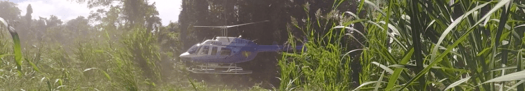
3. The jungle is very good at hiding objects which lay on the ground. It is not long before vines and young tree shoots rise up from the ground and obscure or completely cover a ground object. Continual heavy rain also washes soil against an object on the ground. When I first went to Papua New Guinea in 1987, I worked for a helicopter company. The owner described a Lockheed Lightning P-38 crash site he had been to as completely hidden by jungle vines and debris such that you could walk three metres away from it and not see it. Tree droppings and vines when they breakdown, contribute to forming compost in which other plants can grow, covering and enveloping a wreck. Lieutenant Backhouse on Patrol A1 referred to the “odd looking mound which turned out to be the main wreckage,” but he was looking for the wreckage as they had already found an engine and “where was the rest?” – the rest of the aircraft they “expected” to be able to see. Lieutenant Backhouse went to the mound to investigate and what he found was that the “odd looking mound” covered in vines was the main wreckage. If they had not literally “bumped into” the engine, it is possible that they would have walked right through the site without seeing the main wreckage under the vines.
The aforementioned three factors are enough to explain why this wreck had not been seen in the eight intervening years between 1937 and 1945, and since. It is only because the Australian Army infantry battalions in the area in 1945 had a policy of extensive patrolling in the area to seek out Japanese positions to the west of the bomb-line that we are able to know of the find of this wreck today. Even then, it is because Patrol A1 took an alternate route back to their base that we know of this find in the jungle.

What is the current situation?
First, I have to relate what happened in 1994 and 1995 when the local Pomio people were informed of the importance of any wreck that they find but that what we suspected of the wreck seen by the Australian Patrol was that it was a long enduring mystery and very important. They then decided that they would make the search a “Kommuniti Projekt” – community project.
In 1996 we made two visits, one visit early in the year and the second visit around about September. Details of the second visit in 1996 are related later.
On the first visit in 1996, I was told that the coastal communities met and had asked the assembled people if anyone had any knowledge of an aircraft wreck in the area, “Had anyone seen anything of an aircraft or parts of an aircraft in the area?” Of course, the various scattered parts of the B-17 that they knew of in the Mumus river valley were mentioned but one man, who was not from their local community, stood up and announced that he had seen another, different aircraft but there was a problem…he would not say where it was.
Upon hearing about this meeting, I asked them, “Who is this man, bring him to me or I will go to him and speak with him?” They told me that the man was not from their village and that he was not a Pomio and that he had been “Maus pas,” meaning “mouth fast” or as we say, “tight-lipped” after his announcement and would not say any more. There was a feeling amongst the local people that it was bravado on the part of the man and that he had not seen anything and was boasting. There the matter ended for the time being.
During the visit to the area in 2011, I began to hear from the local people that the aircraft wreck we all were seeking was buried. The Pomio people had been told by the brother-in-law of a former bulldozer driver who had worked for the timber company that the bulldozer driver had seen the wreck and had buried it. The brother-in-law of the driver did not know where it was buried as the bulldozer driver had been working alone and had only told the brother-in-law that it was indeed buried and had sworn him to secrecy. The Pomio people suspected they knew “where,” but their interpretation of “where” it was buried was outside the bounds of where I knew the extent of the Australian A1 Patrol had taken place and it could not be where they were indicating it may be buried. The news that something had become known about the wreck in the area and that the wreck was buried was a relief in one regard because we now knew why we had not seen it in our searches to date. But why had it been buried and by whom? The story emanating from the brother-in-law of a bulldozer driver who had worked for the logging company was very interesting but gave no reason as to why it had been buried.
It transpired that a bulldozer driver named Alvinus from the Baining tribe, had been working alone making a track through the jungle for the logging company and had come up against something which would not move. He had peered through the underbrush and saw that it was the wreck of an aircraft and realised that it must be the one that was being searched for by my team and by the Pomio people. Being that the bulldozer driver was from another tribe, it was explained that he then promptly buried the wreck. This man was the same man who had been to the Kommuniti Projekt Meeting in early 1996.
Papua New Guinea is very tribal and some tribal fights achieve the status of a Papua New Guinea “Hatfield and McCoy” vendetta and go on for years resulting in deaths and injuries. Although there is no actual tribal fight going on in Wide Bay, there is a land dispute simmering due to the sale of land by people of the Baining Tribe to the central government – a sale which took place many years ago. The land in question is said by the Pomio people to be their ancestral land – sold from out under their feet by the Baining people from across the main river, to the central government and represented in the sale as “their” land. Anywhere in the world this would raise hackles and rightly so.
The land in question is where the wreck was seen by the Australian Patrol and now, as related, by the bulldozer driver Alvinus and then buried by him probably by pushing soil from the made logging tracks over the hillside and down onto the wreck site as we do know that the wreck seen by Patrol A1 is on a down slope from the ridgeline. Alvinus would be fully aware of the land dispute.
During this visit in 2011, I broke my left arm a couple of days after arriving and was incapacitated, taped up and unable to take any further part in the expedition. On returning to Australia and after a period of recuperation, I went back in alone, later in 2011, and took a boat and landed at the coast and walked up to a local village and met with Joseph Komen. Joseph was speaking to me while I treated a young boy for injury and who had fallen off his bicycle and had very bad gravel rash on one knee. Joseph told me that the community now had more information and that the aircraft wreck had indeed been buried on purpose and that the aircraft wreck had been buried out of jealousy. Tribal jealousy. The bulldozer driver had been a Baining, a member of the Baining Tribe. The area where the wreck was had been Pomio land and there was a dispute going on for years over the ownership of the land and that there was animosity between Pomio and Baining. Luckily, geography prevented the two tribes from continual meetings as one lives to the north of the Mevelo River and the other to the south of the river.
I heard more on reaching the main village area and meeting up with Barnabas.
The bulldozer driver, Alvinus had been making the tracks alone but was being followed up on the tracks by his brother-in-law Kopek. Kopek is from yet another tribe and is a Tolai. Kopek was delivering river gravel to lay down on the trickier parts of the track to what is called “metal the track” and make it hard. None of the tracks in the jungle are all weather tracks, they are viewed as temporary tracks in order to get the logs out. Abandoned tracks form water courses in wet weather and it is not unusual to see washouts one metre to two metres deep on the downsides of these tracks.
Alvinus buried the wreck while his brother-in-law was busy with the gravel truck down in the riverbed and Alvinus laid a new track away from the wreck with the track going around the wreck site. He later told his brother-in-law that he had buried the wreck but swore him to secrecy. The year when this happened must have been 1996 and it must have occurred between the times of our two visits in that year and would be when the Open Bay Timber Company started to prepare for total logging in the area and employed Alvinus to make the access tracks. Unfortunately, Alvinus cannot tell us where he buried the wreck he bumped into, for Alvinus died in the year 2000. The end for Alvinus was not good. He was taken by a crocodile while fording the Mevelo River…
As mentioned, my search team made two visits to the area in 1996. On each visit to the area, one member of the team, Jason, kept a journal. The journal notes were sent to me late in 2015 in order to expand them from my recollections and use them in the re-write of the project story for this website. On refreshing my memory from the notes, I recalled that on the second visit to the area in 1996 we had ventured quite a way from our campsite on the Mevelo River and were on a ridgeline to the south and had completed our search plan and were then on a bulldozer track heading southeast. I was figuring out how to get back to camp by the easiest route which would mean turning left and heading north down into a creek and up another smaller creek bed to the next ridgeline then turning again to the northwest. Whilst reading Jason’s notes on this part of the trek I realised from memory that we had been walking past a large patch of cleared ground off to the left with loose bare earth and I did recall saying to the team member beside me, “What happened here I wonder.” I also recall that at the time, that I thought the area may have been cleared as a site to store logs waiting to be shipped out.
This bare earth area we saw in late 1996, fits the description of the wreck site given by the Lieutenant on the patrol and it fits his depiction of where the wreck is by the drawing he made and which is partially shown in Part 4 of this story. At the time in 1996, it never occurred to any of us that the wreck would be buried. We were looking for a wreck on the surface but now that we know of the “burial on purpose,” the bare patch of cleared ground seen in 1996 has significance. Of course, it will not be bare now, it will have sizeable trees on it.
It now becomes imperative that we return to find and thoroughly examine this particular area within the bounds of the search area. The wreck has not been seen by searchers, but it is not forgotten.
Part 1 – The Beginning | Part 2 – PNG History/Topography | Part 3 – Wreckage is Found
Part 4 – Tangible Evidence | Part 5 – Analysis | Part 6 -Lae to Howland Island
Part 7 – Howland area to New Britain – To the Gilberts…
Part 8 – Howland area to New Britain – Flying Westwards for Rabaul
Part 9 – Not Seen, But Not Forgotten
Part 10 – 2017 Expedition Overview
References
HOME | Contact
COPYRIGHT 2004 – 2026
The contents of this website are Copyright to David Billings. No portion of this website story may be used without permission. All Rights to the content of this story based on the Earhart Lockheed Electra 10E aircraft being on New Britain Island are Copyright to David Billings and the story is the Intellectual Property of David Billings.
